Aerial Survey
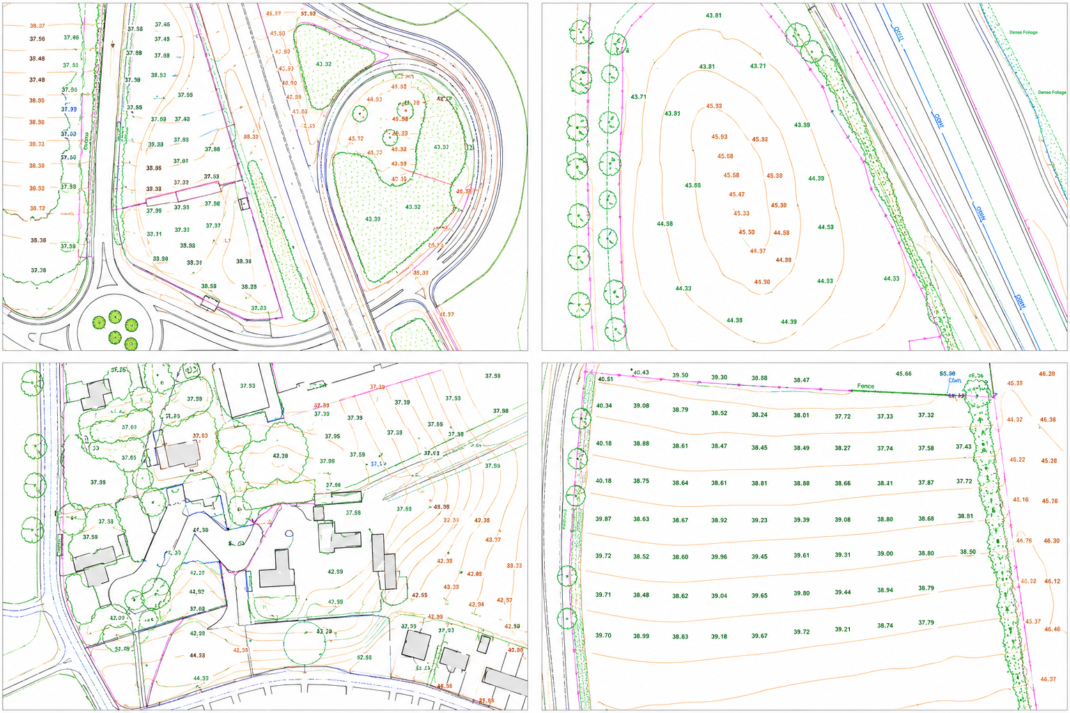
Survey-controlled UAV photogrammetry delivering orthomosaics, DSM/DTM, contours and volumetric analysis. OSGB36 georeferenced to sub-5cm accuracy across corridors up to 100+ km².
Learn more →Geospatial survey, structural inspection and digital asset intelligence for rail, nuclear, utilities, renewables and built environment projects across the UK.
Survey-grade geospatial data, LiDAR scanning and digital inspection delivered to engineering consultancies, asset owners and principal contractors.
All Services →Survey-controlled UAV photogrammetry delivering orthomosaics, DSM/DTM, contours and volumetric analysis. OSGB36 georeferenced to sub-5cm accuracy across corridors up to 100+ km².
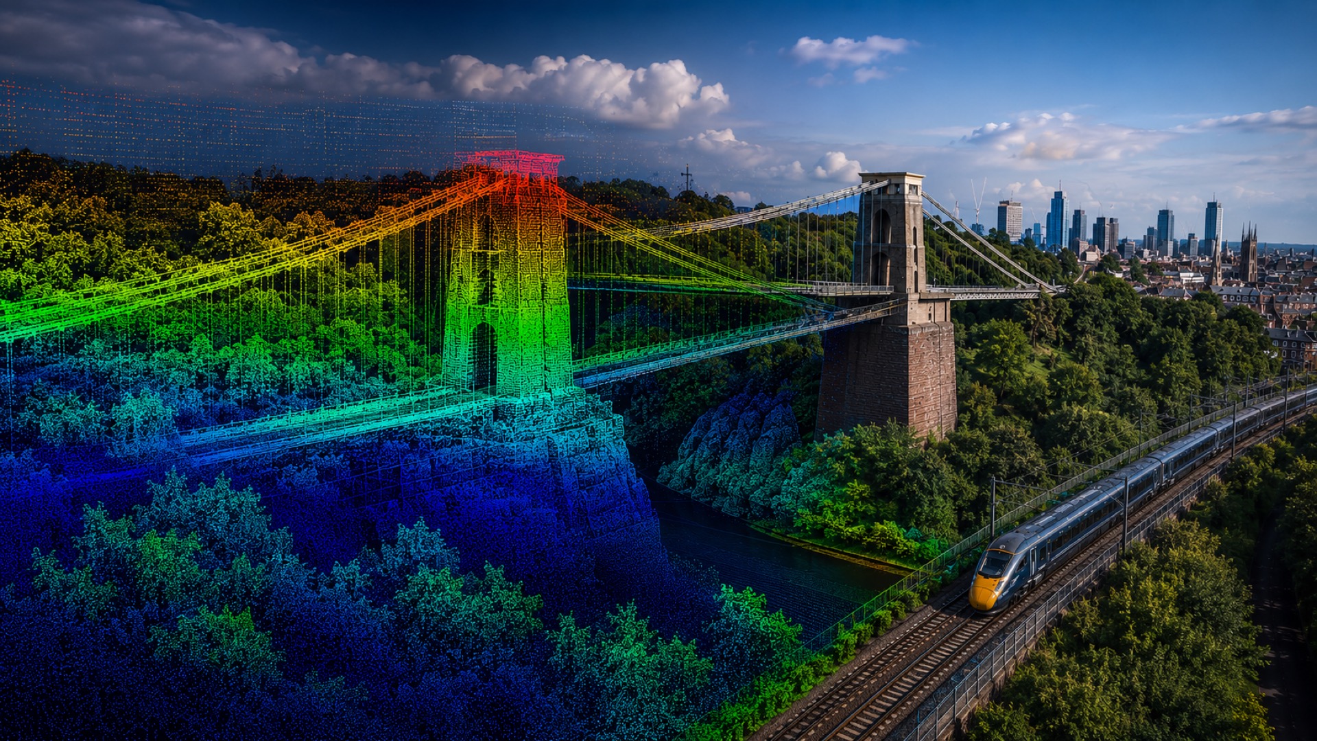
Learn more →UAV and terrestrial LiDAR producing dense, engineering-grade point clouds. ±2mm accuracy, BIM-ready and suitable for structural assessment, CAD extraction and clearance analysis.
Learn more →Photogrammetric 3D models and cloud-hosted digital twins. Fully measurable, shareable with any stakeholder, and integrated with point cloud for asset lifecycle management.
Learn more →UAV and ground-based camera rig inspection of bridges, viaducts, retaining walls and facades. Georeferenced defect mapping without scaffold or rope access — delivered as condition reports or hosted models.
Learn more →Collision-tolerant indoor UAV inspection of tanks, vessels, boilers, chimneys, silos and inaccessible voids. Full internal coverage in GPS-denied, unlit environments — zero manned entry required.
Learn more →RICS-standard floor plans, sections, elevations and roof surveys. Point cloud capture of existing buildings for planning, refurbishment and BIM delivery — accurate to ±5mm.
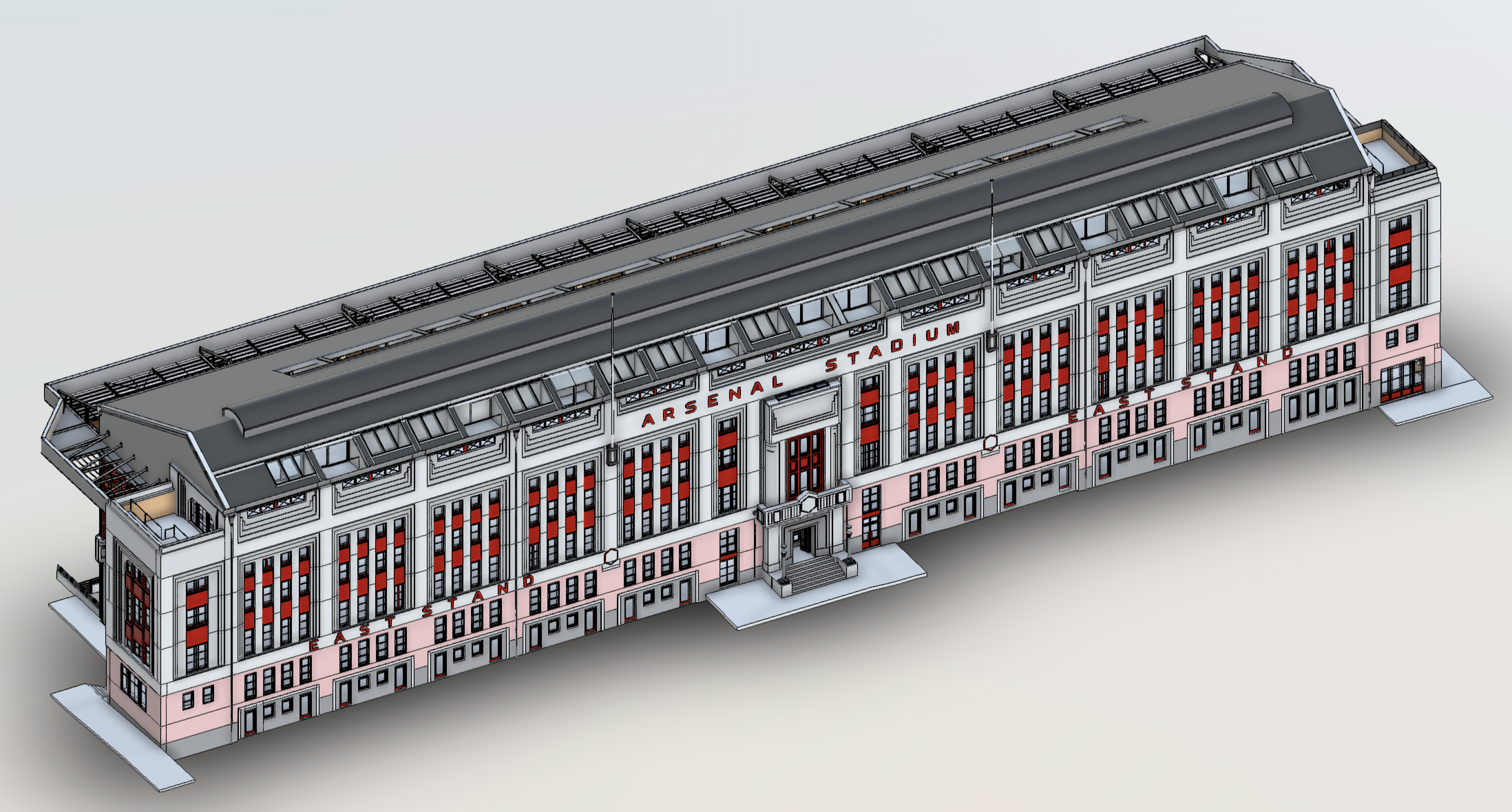
Learn more →Scan-to-BIM Revit models from point cloud and measured survey data. Delivered to LOD 2–4 for architectural, structural and M&E disciplines — federated and IFC-ready.
Learn more →Cloud-hosted inspection models, measurable point clouds and digital twins — giving engineering teams a single live reference for the asset's entire life.
Photogrammetric mesh models hosted online — fully measurable, accessible from any device, shareable with any stakeholder.
Repeat-capture change detection to sub-millimetre precision. Baseline comparisons flagged automatically against previous scans.
Every inspection linked to a timeline. Track structural change over months and years with georeferenced before-and-after comparison.
Outputs compatible with AutoCAD, Revit, QGIS, ArcGIS, IFC and all major inspection management platforms.