Measured building survey.
Precision documentation of the built environment.
RICS-standard laser scan surveys of buildings, structures and heritage assets. Floor plans, sections, elevations and 3D point cloud models delivered in CAD and BIM-ready formats to engineering accuracy.
What is a measured building survey?
A measured building survey is a dimensionally accurate record of an existing building. We capture the geometry by terrestrial laser scanning, total station and handheld scanner, and process the data into 2D floor plans, sections and elevations — and, where required, a 3D point cloud, a Revit / IFC model and a federated BIM file.
The survey is the existing-building base that architects, structural engineers, M&E consultants and BIM coordinators work from for refurbishment, conversion, retrofit, listed-building consent, facade remediation, planning applications, facilities management and as-built verification. Every project is delivered under the RICS Surveys of Land, Buildings and Utilities professional statement, with documented control, independent dimensional verification and a full QA record issued alongside the drawings.
Angell Surveys is a RICS-regulated practice (Firm 681790) — verify our registration via the RICS public Find a Surveyor directory.
Accurate, RICS-standard survey documentation.
Our measured building survey service provides accurate 2D and 3D documentation of buildings, structures and heritage assets. Using terrestrial laser scanning (TLS), we capture complete geometric data in a single site visit — delivering floor plans, sections, elevations and 3D models to RICS guidance and client specification.
Scan data is processed to produce clean, dimensionally accurate CAD drawings and BIM-ready point clouds. All survey work is conducted under a documented quality management framework with independent accuracy verification against established control.
We work across the full range of built environment projects — from pre-purchase condition surveys through to listed building documentation, construction verification and facilities management data capture.
What we deliver.
Complete building documentation from laser scan data to RICS-standard CAD and BIM deliverables.
Floor Plans, Sections & Elevations
2D CAD deliverables produced from scan data to RICS guidance. Includes room dimensions, structural elements, openings and fittings as specified, at scales from 1:50 to 1:200.
Laser Scan Point Cloud
Full-building TLS survey delivering a geo-referenced, millimetre-accurate point cloud. Suitable for BIM conversion, planning applications and structural assessment.
Roof & External Survey
External elevations, roof geometry and site boundaries captured by TLS and UAV photogrammetry. Combined with internal data for complete and consistent building geometry.
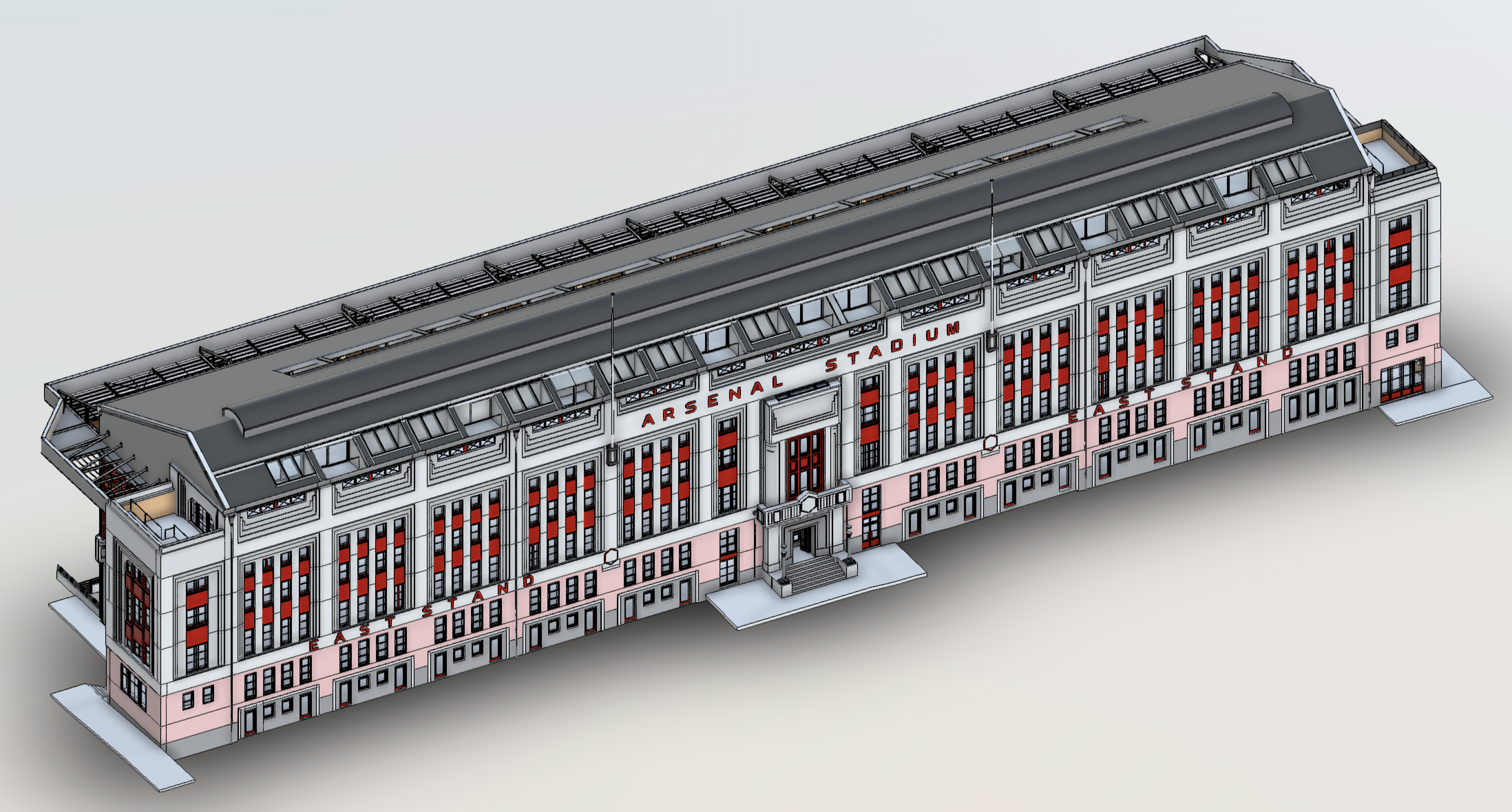
Heritage & Listed Building Survey
Specialist measured survey of historic and listed structures to Historic England guidance. High-density scan data captures complex geometry, decorative features and structural anomalies.
Construction Verification
Pre/post-construction as-built survey to verify work against design intent. Dimensional checking and deviation reporting against BIM or CAD drawings to agreed tolerances.
Facilities Management Data
Structured, attributed floor plans and room data books for FM systems. Area schedules, space categorisation and asset tagging delivered to client specification and format.
How we work.
RICS-compliant survey workflow from brief through to checked, issued drawings.
Survey Brief
Requirements defined against RICS guidance. Level of detail, drawing standards and coordinate system agreed. Site conditions, access arrangements and heritage sensitivities confirmed.
Laser Scan Capture
TLS survey conducted from systematically planned station positions. Target-based registration control established. Complete coverage verified before demobilisation.
Processing & CAD Production
Point cloud registered, cleaned and referenced. CAD drawings produced by experienced surveyors from scan data and checked against specification before issue.
Issue & Review
Drawings and data issued to agreed format and revision. Random measurement verification included as standard. Revisions accommodated within agreed scope.
What you receive, to what standard.
Every measured building survey ships with this baseline. Optional outputs are added where the project specification requires them.
| Deliverable | Format | Standard |
|---|---|---|
| Floor plans | AutoCAD DWG, DXF, PDF | 1:50 / 1:100 / 1:200 to RICS layering convention |
| Sections | AutoCAD DWG, DXF, PDF | Cross and long, consistent scale with plans |
| Elevations | AutoCAD DWG, DXF, PDF | All faces, fenestration, articulation captured |
| Point cloud (optional) | E57, LAS, LAZ, RCP | Registered, classified, georeferenced |
| 3D BIM model (optional) | Revit 2022/2024 (.rvt), IFC 2x3/4 | LOD 200–400, federated coordinate system |
| Coordinate system | — | OSGB36/ODN or contractor-defined site grid |
| QA documentation | Control schedule, accuracy report, layer schedule | |
| Drawing accuracy | — | ±5 mm linear, RICS Surveys of Land, Buildings and Utilities statement |
Measured building survey questions.
The questions clients ask us most often before instructing a measured building survey.
What is a measured building survey?
What deliverables will I receive?
What is the difference between a measured building survey and a topographic survey?
Do you survey listed and heritage buildings?
Will the survey be suitable for a planning application?
What CAD layering convention and file formats do you deliver in?
Are you RICS regulated?
Bring engineering precision to your next project.
Most scoping responses sent within one business day.
RICS-regulated work, led by Philip M. Angell MRICS.