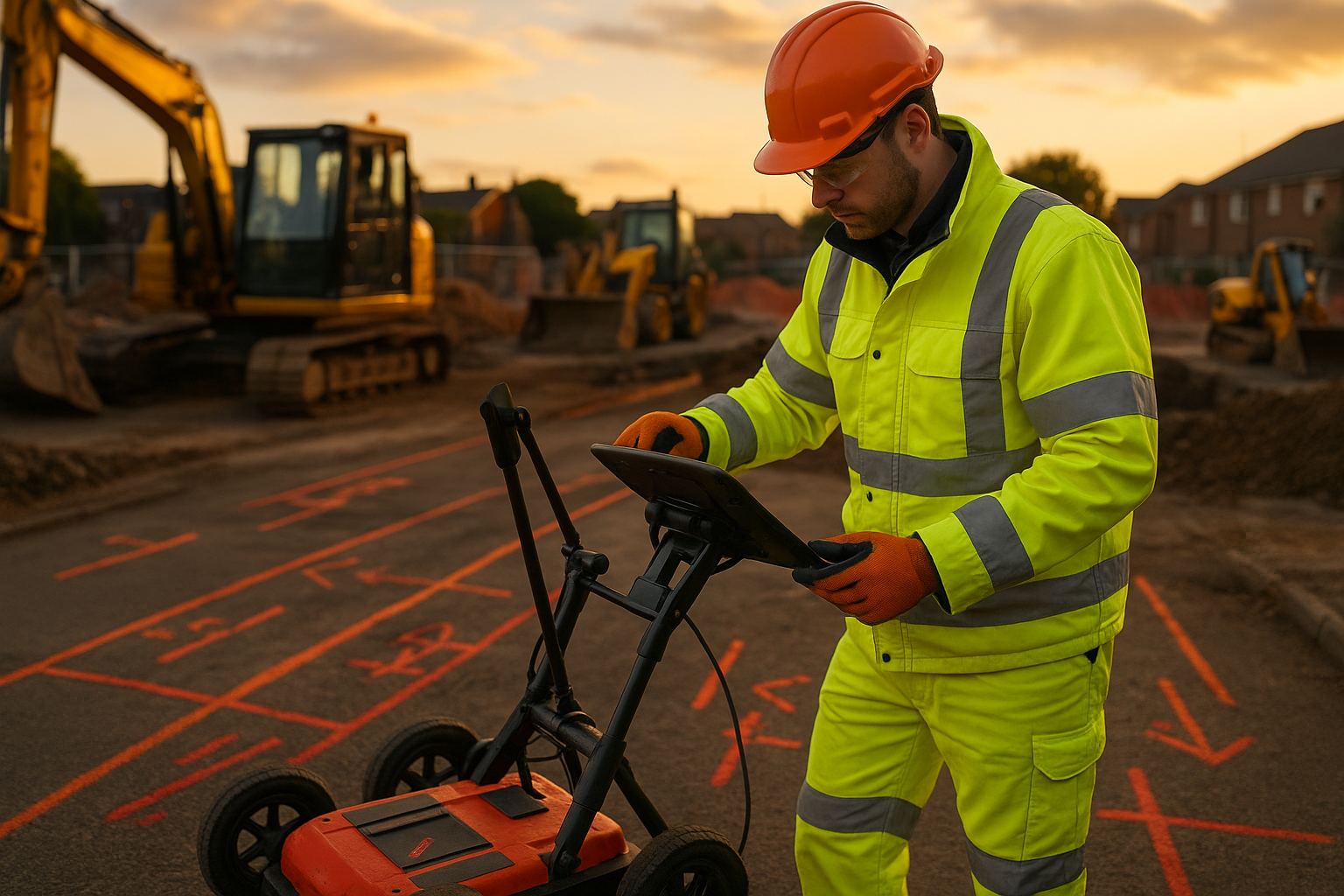
A utility survey is the measured detection and mapping of buried services (water, gas, electricity, telecoms, fibre and drainage) across a site, using ground penetrating radar, electromagnetic location and statutory undertaker records, so that designers and contractors know where live apparatus runs before they excavate. In the UK the recognised specification is PAS 128, which labels every detected line with a Quality Level. This article explains how the detection works, how to read the result, and what the technique cannot tell you.
Need a survey rather than an explanation?
Angell Surveys delivers a PAS 128 utility survey, or a full underground utility survey reconciled against statutory records, on UK sites from QL-D to QL-A, issued as RICS-standard CAD with a full audit trail.
These surveys ensure that before any excavation or construction begins, all buried utilities are precisely located to avoid costly damage or service interruptions. This precise mapping is fundamental for adhering to safety regulations and planning efficient, risk-free projects.
The survey uses detection technologies — principally Ground Penetrating Radar (GPR) and electromagnetic location — to establish the plan position and depth of each buried line without digging for it. Done properly, it removes the main causes of a strike: an unrecorded cable, a diverted main, or a service at a depth nobody expected.
Project planning greatly benefits from the detailed information provided by utility surveys. Engineers and architects use this data to design projects that integrate seamlessly with existing utilities, reducing the likelihood of delays and unexpected costs. Understanding the layout of underground utilities is not just a technical requirement but a critical step in ensuring the smooth execution of construction activities.
What does a utility survey actually detect?
The job is to find what is under the ground before anyone breaks it. That means identifying each buried service, fixing its position and depth, and saying how it was found — which is why the RICS specification for land, buildings and utilities and PAS 128 both insist on recording the method, not just the result.
The definition in one paragraph
The process is the detection and mapping of buried services — water, gas, electricity, telecommunications, fibre and drainage — on a defined site boundary, then the reconciliation of what was found against the records held by each statutory undertaker. The two together are what make the drawing trustworthy; records alone routinely show apparatus in the wrong place or omit it entirely.
Detection relies on geophysical techniques rather than excavation. Ground Penetrating Radar (GPR) is often used to identify non-metallic objects buried underground, while electromagnetic location and radio detection are employed to detect metallic utilities. By locating these utilities, surveyors can create accurate maps that assist in planning and excavation work.
Which type answers which question?
Different questions need different levels of investigation. Records searches (PAS 128 QL-D) establish what the statutory undertakers believe is there. Site reconnaissance (QL-C) walks the ground and checks the records against visible surface evidence — covers, markers, valve boxes, cabinets. Geophysical detection (QL-B) finds the apparatus itself. Intrusive verification (QL-A) exposes it and surveys it in place.
Ground Penetrating Radar (GPR) surveys offer a non-invasive method to detect non-metallic utilities, and electromagnetic location is primarily used for detecting metallic objects. Furthermore, radio detection helps in identifying and mapping utilities by picking up signals from buried cables and pipes. Each type of survey is chosen based on the specific requirements and conditions of the site, ensuring accurate and efficient utility detection and mapping.
How are buried services detected?
Two physical principles do most of the work: electromagnetic induction, which finds conductive apparatus, and radar reflection, which finds anything with a dielectric contrast against the surrounding ground. Everything else is verification.
Electromagnetic and Radio Detection Methods
Electromagnetic signals are essential for many types of utility detection. The Cable Avoidance Tool (CAT) and Signal Generator (Genny) are widely used tools in this method. They work by generating electromagnetic signals that help locate buried cables and pipes.
Radio detection is another critical technology. This geophysical technique involves sending radio waves into the ground, which bounce back upon hitting an object. This data is then analysed to pinpoint the location of utilities.
These methods are particularly useful for detecting metallic utilities without disturbing the ground.
Ground Penetrating Radar (GPR)
Ground Penetrating Radar (GPR) is pivotal in utility surveying. This technology uses high-frequency radio waves to create detailed images of what lies beneath the surface.
GPR systems send radio waves into the ground, which reflect back from different materials and interfaces. Specialist software then processes these reflections to produce real-time images that help surveyors map underground utilities accurately.
GPR is highly effective for detecting both metallic and non-metallic utilities, making it an indispensable tool for comprehensive underground mapping.
Other geophysical and verification methods
Advanced geophysical surveying encompasses a range of modern techniques and technologies. Electromagnetic detection, vacuum excavation, and acoustic methods are some of the most notable.
Electromagnetic detection interacts with the earth’s magnetic fields to locate buried objects. Vacuum excavation involves using high-powered air or water jets along with an industrial vacuum to expose utilities safely. This is often used in conjunction with other detection methods for verification.
Acoustic methods use sound waves to detect utilities with high precision. These techniques are valuable for their non-destructive nature and their ability to provide high-resolution data, ensuring accurate mapping and planning for construction projects.
When in a project should the survey happen?
Integrating utility surveys into project planning helps ensure that construction projects remain on schedule, within budget and compliant with legal requirements. Detailed utility survey data can mitigate financial and safety risks by identifying potential hazards early, while also assisting in adherence to safety legislation.
How the data is used in design
Incorporating utility survey data into development projects starts with collecting comprehensive information on underground utilities. Using methods such as Ground Penetrating Radar (GPR), this data is transformed into detailed maps or 3D models. These assets enable project planners to visualise the existing infrastructure and make informed decisions prior to excavation.
Planners can adjust project designs and timelines according to the precise locations of utilities. This preemptive approach minimises disruptions and delays that often arise from unexpected utility encounters. Additionally, engaging with utility companies early in the project ensures that there are no conflicts or project stoppages. Knowledge of the utility layout also helps in optimising the placement of new infrastructure to prevent future complications.
Why a utility strike is the risk worth avoiding
Mitigating financial and safety risks is a primary benefit of comprehensive utility surveys. Identifying the locations of underground assets prevents accidental strikes during construction, which can lead to severe safety risks for workers and the public. Accurate surveys significantly reduce the likelihood of injuries or fatalities caused by hitting a gas or electricity line.
From a financial perspective, utility strikes can result in substantial project costs. Delays and repairs increase budget overruns, while certain transgressions can lead to huge fines. Accurate utility surveys provide a vital safeguard against these unforeseen expenses. They also protect equipment and materials from damage, preserving the financial health of a project.
What the law and CDM 2015 require
Ensuring legal compliance is critical. Utility surveys play an essential role in meeting regulatory standards. Compliance with safety legislation mandates that all project risks, including those associated with existing utilities, are thoroughly assessed and mitigated.
Accurate as-built records provided by surveys ensure that new construction aligns with previously approved plans, avoiding legal disputes and potential fines. This due diligence represents not only best practice but also a demonstration of responsible project management. Engaging in proper utility surveys showcases a commitment to upholding legal and safety standards, which is crucial for securing permits and maintaining a project’s reputation.
How do you choose a utility surveyor?
Choosing a reputable utility survey provider involves examining their expertise, understanding their survey deliverables, and assessing their ability to meet specific project requirements with precision and efficiency.
What to check before appointing
When selecting a utility survey provider, it’s crucial to consider their experience and qualifications. Providers with extensive industry experience are more likely to handle complex surveying challenges effectively. Look for surveyors who are proficient with advanced techniques such as Ground Penetrating Radar (GPR) and other non-intrusive methods to ensure accurate detection of underground utilities.
Professional standing is also essential. Check that the firm is regulated by RICS, that its surveyors are competent to PAS 128 and can say which Quality Level they work to, and that it can show case studies of comparable delivered work with the deliverables described. Additionally, ensure the team comprises professionals equipped with the latest technology and tools, enhancing the precision of the surveys.
What the deliverable should contain
A reputable utility survey provider should offer clear, comprehensive survey deliverables. Deliverables should include data in various formats, like digital formats (CAD), PDF formats, and 3D models if needed. This ensures compatibility with your project’s needs. Before finalising a provider, request a sample report to evaluate the detail and clarity of their reports.
Survey reports should summarise findings, outline detected utilities, and include high-resolution images or maps. The information should be presented in an organised manner, making it easy to integrate with other project documentation. Furthermore, understand the timeline for when deliverables will be provided to align with your project schedule.
Frequently asked questions
What is the difference between a utility survey and a topographic survey? A topographic survey measures what is visible above ground — levels, kerbs, buildings, trees, drainage covers. A utility survey measures what is buried beneath it. They are usually commissioned together and delivered on the same coordinate system so the designer can see surface and subsurface on one drawing, but they use entirely different instruments and are reported to different specifications.
Does a utility survey find every buried service? No, and any surveyor who says otherwise should be avoided. Geophysical detection has physical limits: deep or small-diameter plastic pipes with no tracer wire, apparatus under reinforced concrete or heavily made ground, and services running directly beneath other services can all go undetected. This is exactly why PAS 128 labels each line with a Quality Level — the label states how the line was found and therefore how far it can be trusted.
What is the difference between GPR and electromagnetic location? Electromagnetic location detects a signal on conductive apparatus: either the signal already present on a live power cable, or one induced or injected by the surveyor. It is fast and reliable on metal pipes and cables but blind to plastic. Ground Penetrating Radar transmits a radar pulse into the ground and records reflections from any change in material, so it can see non-conductive pipes, ducts and voids — but its performance drops sharply in clay and in wet, conductive soils. The two are complementary, which is why a QL-B survey uses both.
Can a utility survey see inside a pipe? No. Detection establishes where a line runs and how deep it is; it says nothing about internal condition. Internal condition needs a camera — a CCTV or culvert inspection for drainage and sewers, or in-pipe inspection for larger process pipework.
Who normally commissions a utility survey? On a construction project it is usually the designer or the principal contractor, because CDM 2015 places the duty to assess buried-service risk on them. On an asset-management project it is normally the asset owner or their framework consultant. Either way the brief should state the site boundary, the planned works and the Quality Level required, because those three things determine the method.
Need a utility survey?
If you are commissioning an underground utility survey on a UK project, Angell Surveys delivers PAS 128 detection from QL-D to QL-A, with every line classified by Quality Level and issued as RICS-standard CAD with a full audit trail. Request a quote and tell us the site, the planned works and the Quality Level you need.